Get aerial map of crops from UAV with precision up to 2 cm/pixel.
Detect and calculate damaged area of crops with help of our intelligence engine for images recognition and interpretation.
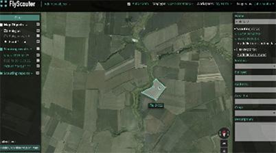
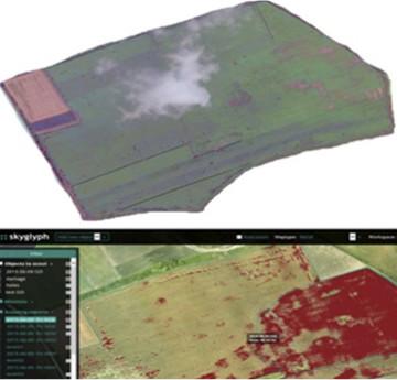
Deliver results to your computer in the couple days via our cloud system ::skyglyph.
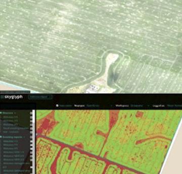
 Crop profiling- Creating visual or NDVI orthophoto of field
- Fields statistic (fields boundaries, fields area, crops area)
- Plants stress assessment (based on NDVI)
-Delivering results througth web
Crop profiling- Creating visual or NDVI orthophoto of field
- Fields statistic (fields boundaries, fields area, crops area)
- Plants stress assessment (based on NDVI)
-Delivering results througth web Crop monitoring- Creating visual or NDVI
orthophoto of field
- Plants stress assessment (NDVI)
- Visual monitoring (planter skips, growth stage, density, uniformity)
- Early stage risks detection: weeds, damages by insects, irrigation needs, crop damages
- Detection of changes in comparision with previous images
- Delivering results througth web
Crop monitoring- Creating visual or NDVI
orthophoto of field
- Plants stress assessment (NDVI)
- Visual monitoring (planter skips, growth stage, density, uniformity)
- Early stage risks detection: weeds, damages by insects, irrigation needs, crop damages
- Detection of changes in comparision with previous images
- Delivering results througth web Claim evaluation- Creating visual or NDVI
orthophoto of field
- Collecting of low-altitude
detailed crop images
- Detection the damaging area of crops
-Delivering results througth web
Claim evaluation- Creating visual or NDVI
orthophoto of field
- Collecting of low-altitude
detailed crop images
- Detection the damaging area of crops
-Delivering results througth web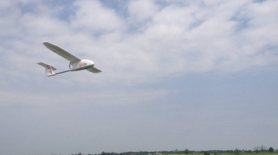

Saving efforts, time and money
in comparison with on-foots scouting. You can survey more than 200 ha per hour, dramatically improve your performanse and save time for productive work.

Superior quality
and 100% correspondence with reality, decrease risk of the fraud

Acceleration
of the claim process, increasing of clients loyalty

Prevent
losses due risk detection on early stages

Easy of using
no special technical skills, no drones, no training, computers and additional pesronnel

Safety
we use drones instead of people for climbing to roof or chimney

Information Safety
we are using leading cloud data centers to provide your confidentiality and security
Write us
[email protected]Also you can contact us here
Telegram: SkyglyphVisit us
36 Vitosha Blvd., apt. 8More about on social media


